 Technology is ever-evolving, so engineering and constructions professionals must continuously seek new and better solutions to daily challenges. One such solution — 3-D laser scanning — helps with the time-consuming task of documenting existing project conditions.
While accurate documentation can be a struggle, it’s also vital for success, especially when a project requires critical connection or penetration locations for existing structures, equipment, piping and other elements.
3-D laser scanning is a fast, safe and accurate way to obtain that data. Its use dramatically improves processes and workflows, making tape measures on a job site so last century.
What Is LIDAR?
3-D scanning — often called LIDAR for Light Detection and Ranging — is a remote sensing method that uses light to measure distances and dimensions. The technology has the potential for countless applications. U.S. troops have used it to map difficult terrain in Afghanistan, and the National Ocean Service uses it for things like shoreline mapping, emergency response and coastal vulnerability analysis.
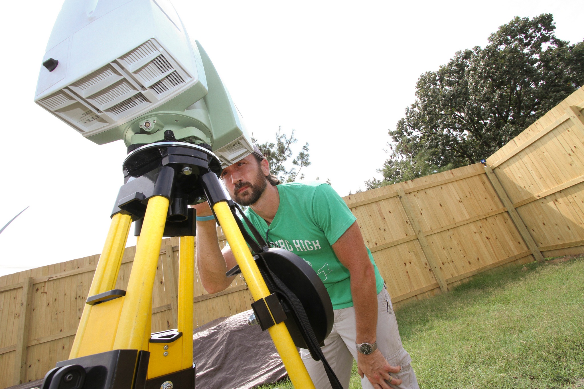
The most common tool of the technology in our industry is the stationary 3-D scanner. Placed in the project environment, it measures the distance of an object’s surface from the scanner and maps the points to a 3-D XYZ coordinate system file called a “point cloud.” Each scan produced is extremely accurate, providing precise measurements to within 2 millimeters.
Why Use 3-D Laser Scanning?
3-D laser scanning captures data quickly and safely with detail and accuracy that traditional tape measures can’t match. Any project with existing construction can benefit from this precision, especially those designed before the advent of CAD modeling. Laser scanning also offers a nonintrusive and valuable option when measuring hazardous or complex objects.
Project managers, engineers and designers can navigate through point cloud data with confidence, trusting that the information is accurate. The benefits extend beyond viewing and measuring. The point cloud can be incorporated into design applications like AutoCAD to improve the overall quality of the design and design documents. With exact existing conditions referenced in your 3-D design model, your new design is more accurate.
Users of these 3-D laser scanners also benefit from reduced design rework and the opportunity for off-site fabrication. The technology is a valuable tool in the continuous management of asset and building information modeling (BIM) data. And it helps enable collaboration between architects, engineers, constructors and owners.
It’s not a matter of if you’ll use laser scans on your projects — it’s a matter of when. Scanning is becoming the standard method — and in some cases the only way — to obtain accurate existing conditions on a project. As an engineering firm or subcontractor, you may not collect the scans, but the owner may provide them to you.
Interested in learning more? I’ll be presenting “ 3-D Documentation at the Speed of Light” at the IDEA Conference at 4:30 p.m. on June 29 in Boston. We’ll discuss the benefits of laser scanning and how to leverage the technology on your next project.
Are you intrigued by the idea of tossing out your tape measure in favor of a high-tech solution? I’d love to hear more about your practical experiences with laser scanning on a job site!
Jim Smith is a senior applications support specialist at Burns & McDonnell, focusing on 3-D design review and collaboration, 3-D modeling, construction sequencing, rendering and animation presentations. Connect with Jim on LinkedIn.